Sailing the Tropics
|
Sailing the Tropics
|
|
|
In the Mediterranean we are not used to some peculiar aspects of ocean navigation and to some specific aspects of sailing in the tropics; I'll try to summarize: - TIDES: Even if we never had 10-meter tides like in St.Malo, at least a couple of meters were quite common and occasionally we had up to 4-5 meters. This has two consequences: - anchorages: one needs to take the tide into account, so to not touch bottom at low tide and at the same time ensuring enough anchor-rode scope at high tide; one normally end up anchoring in deeper waters than would normally be considered safe in the Med, and anchoring in about 20 meters of depth is not at all uncommon. - tidal currents: tides move huge masses of water, which may lead to strong currents even in the open sea, sometimes up to 1-2 knots and therefore to be reckoned-with. In narrow passages, currents may even reach as high as 10 knots, as we experienced in the Tuamotu atolls and between the islands of Indonesia: running through a narrow with a favourable current may be a terrifying experience, and with the tide against it's simply impossible! - CLIMATE: Due to the strong evaporation, the sky is almost never clear, there are always clouds which cause frequent, usually short but strong rainstorms which may come together with wind gusts at 30, sometimes even 40 knots. At night luckily they show up on radar, but it's not always possible to dodge them because they move quickly and unpredictably.
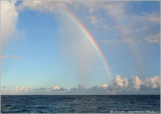
A typical sailing day in the Tropics: sunshine, but also small showers moving along quite rapidly, and often carrying short wind gusts Real full-fledged depressions are not common, at least in the meaning of weather systems like the ones we are accustomed with; there may be very large cloud formations, especially in conjunction with the Inter-Tropical Convergence Zone (ICTZ), but they tend to be almost-stationary and it's difficult to guess how to get out of them as their movement is quite not obvious! Some consequences: - it rains often! Even when ashore, it' quite common to have rain, sometimes heavy, few times during the day. - the bimini-top: I cordially hate sailing with it, but it's really unavoidable, not only to avoid cooking the poor helmsman in the scorching sun, but also to shelter him from the rain! - when sailing short-handed, sail handling is unavoidably slow
(and one of the two may be below-decks sleeping, to begin with!): this led us to
favour sail sets that could be easily handled by a single person from the
cockpit. - CORAL: No gently sloping beaches, almost everywhere the bottom rises
suddenly from 10-20 meters to almost nothing where the coral reef begins!
Unavoidably, one must anchor well off in order to avoid swinging into the reef
if the wind changes!
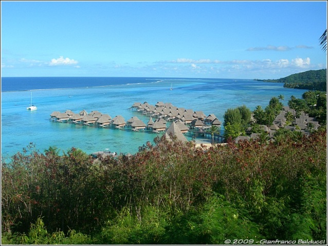
The Reef surrounding Moorea island: the water is mostly shallow, but there are some narrow navigable channels
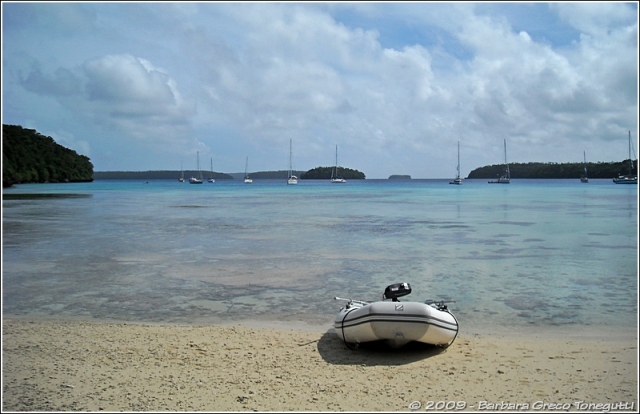
In this harbour on Vava'u island (Tonga) the shallow coral forces all yachts to anchor far away
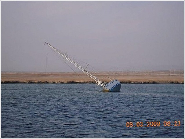
At the entrance to Port Ghalib (Red Sea) a yacht missed the channel and ended on the totally invisible reef
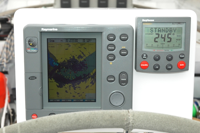
- BOAT HANDLING: Sailing long-distance with a reduced crew, ease of manoeuvre takes precedence over sail-optimisation, therefore: - autopilot (be it electronic or wind-operated): the boat is almost never hand-steered, and the person in the cockpit is more a watchman than a helmsman. - simple sail sets that can be handled with little effort (the poor guy resting under deck cannot be awakened every few minutes!...). - CHARTS: In Europe we have become accustomed to very accurate charts
and to chartplotters that can show our position with a few meters' accuracy;
just out of Europe, the situation changes and charts are VERY inaccurate (no
surprise, most date back to the 1800's)!! It's pointless having a GPS which is
accurate to few meters, if the chart is off by one mile!
In "overlay" mode the radar echo can be superimposed on the nautical chart, highlighting discrepancies
|
|
Webmaster: Gianfranco Balducci - email: gfbalduc@tin.it Last Update: 11/11/2014
The
Shaula4 website (text and images) by Gianfranco Balducci is licensed under a |